Route 651 AV2
Alta Via: Campo dell'Osso - Campo Staffi
- Trail Conditions: On foot
- Interest: Wildlife, Panorama, Religion
- Departure: Piazzale Campo dell'Osso
- Arrival: Campo Staffi
- Duration: 6 hour/s 10 minutes
- Difficulty Level: E - Hiking (level)
- Length: 19.10 km
- Difference in height: Uphill 1,210m - Downhill 970m
- Minimum Altitude: 1,424m
- Maximum Altitude: 1,958m
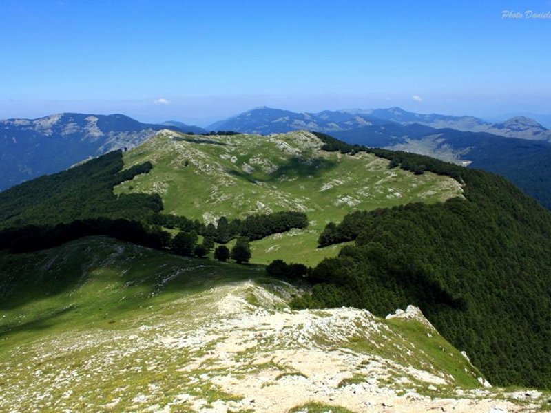
From the square of Campo dell'Osso one follows the asphalted road keeping to the right. After a drinking trough a small path climbs on the right and enters the wood. Once the rise is finished one follows the ridge of Monna dell'Orso which goes on through ups and downs overlooking the Simbrivio valley. A path leads to the panoramic square of the Vedute di Monte Autore.
Further informationBooks and Guides
© 2025 - Parco Naturale Regionale Monti Simbruini


 Download KMZ
 Download in GPX format


