Monte Crepacuore from Campocatino
At the southeastern boundary of the Park
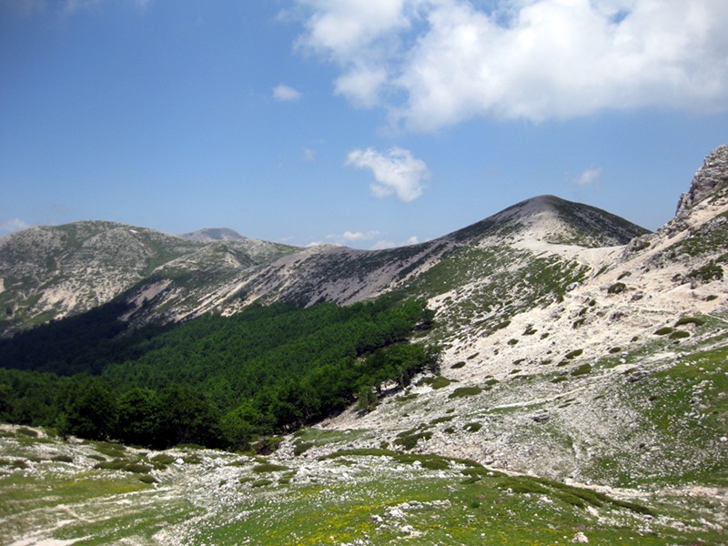
The route runs at the southeastern end of the Simbruini Regional Park, in the upper altitudinal range where trees give way to meadow vegetation, allowing the eye to sweep freely in all directions. Here, according to topographical maps, Simbruini give way to Ernici, but it is interesting to note that, beyond toponyms, in geomorphological terms Simbruini and Ernici are part of the same, long mountain range that begins at the Carsoli plain and ends in the basin of Sora.
From the large square where the road ends, we will cross entirely the large karst plateau of Campocatino and then go up to the Pozzotello saddle, leaving Peschio delle Cornacchie on our left. From the saddle, leaving the path that continues on the ridge to Campovano, we will descend to the Pozzotello Spring, overlooked by Peschio delle Ciavole and Mount Pozzotello, and then ascent the southern ridge of Monte Crepacuore to the summit, from where it is possible to enjoy all the main peaks of the Park and several other mountains of the Lazio and Abruzzo Apennines.
On the way back, back to the Pozzotello Spring we will go around the Peschio delle Cornacchie on its northern slope (Sentiero dei Fiori) returning to Campocatino.
- Difficulty level: easy and short hike requiring moderate physical effort and without specific technical difficulties. Classification according to the Italian Alpine Club's hiking difficulty scale: "E"
- Overall height difference up / down: 350 meters
- Trekking length in km: 10,5
- Planned duration (actual walking hours): 4H30
- Individual equipment: standard mid-mountain equipment suitable for the season. Lack of adequate equipment is cause for exclusion from the hike; if in doubt, ask the organizing Guide upon registration
Province: Frosinone Region: Lazio
Organization: Nicoletta Visani
Info Email: nicoletta@mindthetrek.com Info Line: 3477855705