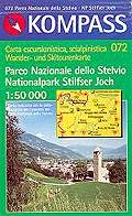
Parco Nazionale dello Stelvio
Nationalpark Stilfserjoch
www.stelviopark.itParco Nazionale dello Stelvio - Carta Escursionistica, Cicloturistica e Scialpinistica 072
Hiking, cycling, and ski touring map. Produced by Kompass with the collaboration of the Park, it reproduces
in scale 1:50000 the territory of the protected area. Besides the
usual symbols representing roads, hiking paths, dirt roads, alpinistic
routes, a detailed symbolism highlights naturalistic elements of the
area, such as the typology of the woodland (spruce fir woodland, larch woodland,
mugo pine woodland), the areas of the most important faunal species (deer,
roe deer, wild goat, etc.), the presence of particularly beautiful
morphological elements in the landscape (lakes, waterfalls, etc.).
- Publisher: Kompass-Karten GmbH
- ISBN: 3-85491-391-5
- Size: 12x19.5cm
- Year: 2007
- Scale: 1:50.000
- Price: 7.50 €

Parco Nazionale dello Stelvio - Carta Escursionistica, Cicloturistica e Scialpinistica 072
© 2025 - Parco Nazionale dello Stelvio


