|
|
Riserva Naturale Regionale Ponte a Buriano e Penna |
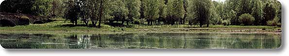
| The Reserve extends itself for about 7 km of length along the course of the river Arno, from the Romanesque bridge of Ponte Buriano to the power station below the ENEL dam of Penna and includes the artificial reservoir of the dam and the neighboring terrestrial areas. The landscape is mainly characterized by the gentle hills surrounding the basin, consisting of fluvial-lacustrine sediments dating back to different periods, with the occasional presence of cliffs and vertical walls. From the paper mill of Ponte a Buriano to Rondine, the river Arno flows confined among the rocks, while from Rondine to Penna the river becomes wider and forms the Penna reservoir. The vegetal landscape is made of downy oaks above all on the sides directly exposed towards the reservoir, of a meagre riparian arboreal strip, of shrub bushes, agricultural fields (situated above all along the left bank of the river Arno) and of a large marshy area in the eastern part of the Reserve. |  |
| www.parks.it | Further info | Weather forecasts | How to get there |
Contacts |
The Area Points of interest Visitor Centers Itineraries Services Environmental education |
What's New Places to Stay Localities Events Typical products Publications |
||
|
|
||||
© 2004/2010 - Provincia di Arezzo |
||||