Valle Ibà and Poggio Grande
- Trail Conditions: On foot
- Interest: Flora, Wildlife, Hystory
- Departure: Museo Palentologico “S. Lai” – Peagna di Ceriale
- Duration: 6 hour/s
- Difficulty Level: intermediate
- Length: 10 km
- Difference in height: 580m
- Localities Crossed: Peagna - Valle Iba' - Pizzo Ceresa –Poggio Grande - ritorno (anello)
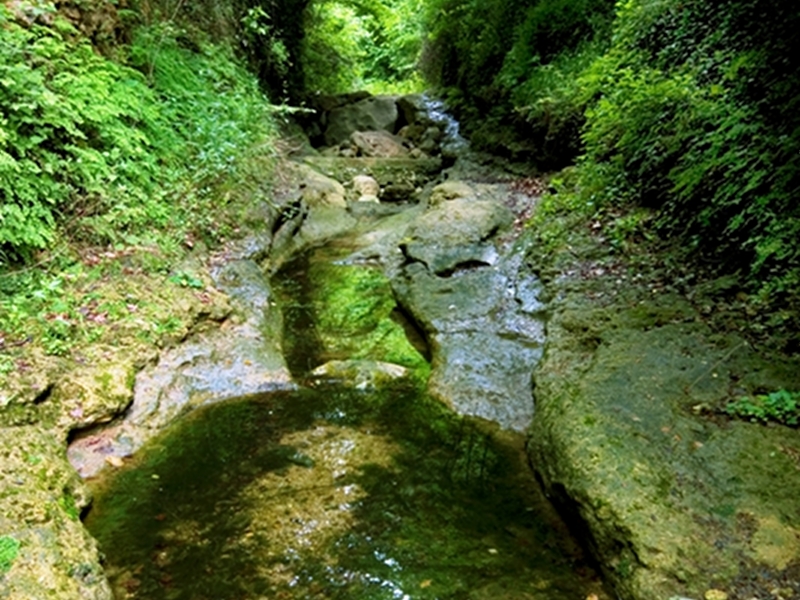
From the Paleontological Museum "S. Lai" (Strada nuova di Peagna, 209) take Via Tecci and Paverne and follow a stretch of asphalt road with the trail marker "empty red circle" or the trail marker "P1". Abandon it at the first hairpin bend to enter the valley of rio Ibà, housing several species of endemic and protected flora. You will cross several environments, from the riparian to the kart environment, from areas interested by reforestation measures to pastures, discovering the traces of the ancient forest and breeding activities, like the so-called "caselle", brickwork arch bridges, charcoal piles. The itinerary ends in a saddle, where the panorama opens towards the Ligurian Alps, with the summits of Carmo, Rocca Barbena, Galero and its spurs, up to Pizzo d'Ormea. Following the ridge of Pizzo Ceresa, you will reach a small chapel dedicated to the war fallen men in the Municipality of Cisano sul Neva, where you will enjoy a wonderful view over the coast, the plain, and the valleys of Albenga. From the small chapel, a dirt road climbs with bends (trail marker "P5") towards the Sanctuary of Nostra Signora della Riconciliazione e della Pace, in the Municipal territory of Balestrino, built at the foot of Poggio Grande, whose summit is dominated by the 19th century Forte dei Due Fratelli, partly used now as a mountain hut. From the Sanctuary (trail marker "red triangle with two vertical bars") follow towards the south-east the ridge towards Mt. Acuto, sunny, dry, and calcareous. At the beginning of the uphill trail towards the summit of Mt. Acuto you can see, on the right, the trail with the trail marker "red double X", branching off from the main itinerary along the watershed, going ahead horizontally. The "fountain trail" develops downhill towards the valley bottom across abundant pastures and dry-stone buildings, and ends on the "panoramic road" (Via Castellaro) behind Peagna di Ceriale. Going ahead on the right, the road leads back to the hairpin bend where the itinerary begins and, then, to the Museum.