


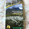
Carta escursionistica ufficiale Parco Nazionale Gran Paradiso (Scala: 1:25000)
Detailed hiking map on a scale of 1: 25000, official cartography of the Gran Paradiso National Park.
For the realization of this paper map, hundreds of kilometers have been covered on roads and paths, recording the tracks with GPS technology.
This work technique allows us to obtain a precise location of all the elements useful to a hiker.
The card is based on the creation of a complete geographical database, structured on GIS software with the following levels:
Waterproof and tear-proof
For the realization of this paper map, hundreds of kilometers have been covered on roads and paths, recording the tracks with GPS technology.
This work technique allows us to obtain a precise location of all the elements useful to a hiker.
The card is based on the creation of a complete geographical database, structured on GIS software with the following levels:
- Hiking information (shelters, bivouacs, unguarded shelters, climbing walls, equipped areas, places of interest, dangerous passages, etc.)
- Map legends and general information (all fully translated into English, French, German)
- Punctual elements such as fountains, pylons and crosses, access prohibitions, caves, etc.
- Primary and secondary trail network, fixed ropes
- PNGP Visitor Centers
- Complete road network
- Type of land (wooded areas, stony areas, glaciers, etc.)
- Lakes, rivers
- State, regional, provincial, municipal boundaries, national parks
- Equidistant 50m, 10m, 5m level curves
- Buildings, industries, churches, cemeteries
- Mountain bike routes
- Naming of hiking trails and itineraries
- Military buildings, fortifications
- Complete toponymy
- Railway stations, motorway exits
Waterproof and tear-proof
- Publisher: Fraternali editore
- ISBN: 978-88-97465-45-4
- Size: 14x24,5 cm
- Year: 2018
- Scale: 1:25000
- Price: 14.00 €
Item temporarily sold out at Emporio dei Parchi
Item temporarily sold out at Emporio dei Parchi
Carta escursionistica ufficiale Parco Nazionale Gran Paradiso (Scala: 1:25000)


© 2024 - Ente Parco Nazionale Gran Paradiso