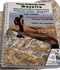
Atlante dei sentieri. Parco Nazionale della Majella
Atlas of the trails with ski touring itineraries - scale 1:25000 - Hiking atlas
Majella - Morrone - Secine - Pizzalto - RotellaThe hiking map in scale 1:25000 is collected in pages, easy to read always when the wind is strong, and with the coordinates along the edges for an immediate use of the GPS.
Index of the names for a quick research of the places, the springs, the mountain huts, and the villages.
Photo album of mountain huts, summits, passes, and important locations, completed with GPS coordinates.
Hiking and ski touring itineraries towards the summits and the tourist resorts.
Restaurants, hotels, holiday farms, hostels, rooms to let of the Park.
- Publisher: Società Editrice Ricerche
- ISBN: 978-88-86610-41-6
- Size: 14.5x23cm
- Year: 2008
- Scale: 1:25.000
- Price: 12.50 €
Item temporarily sold out at Emporio dei Parchi
Item temporarily sold out at Emporio dei Parchi

Atlante dei sentieri. Parco Nazionale della Majella
© 2024 - Ente Parco Nazionale della Maiella


