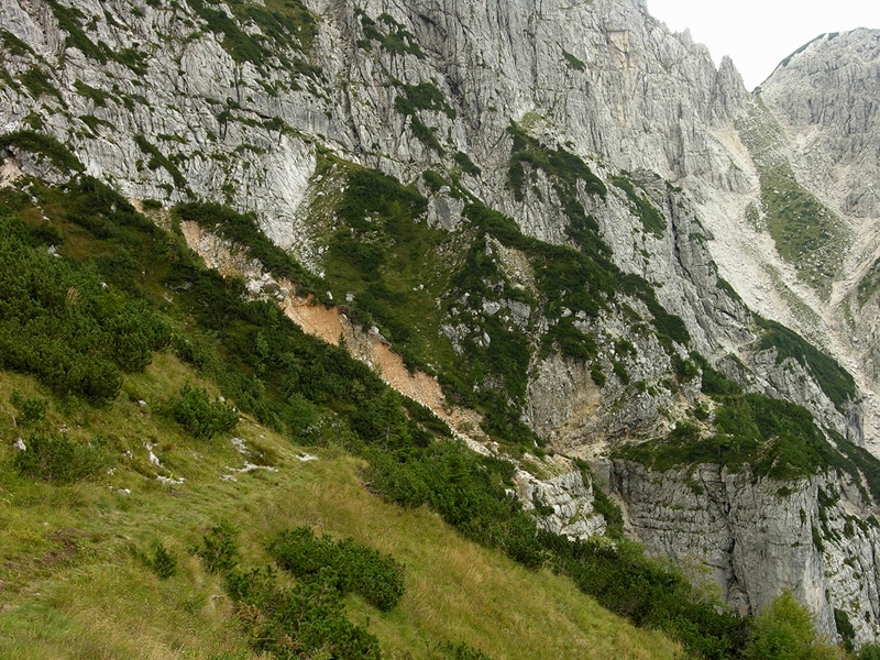
Cròstis valley and Fonderiis mountain pass
- Trail Conditions: On foot
- Interest: Wildlife, Bird Watching, Geology, Photography
- Difference in height: 900 m uphill (climbing to the summit of the Mount Crostis the difference in height is of 940 m).
- Difficulty level: EE. It is a long itinerary in wild and isolated areas. The trails are well blazed and marked, a topographic map will be useful, together with good soil assessment and orienteering skills. No particular equipment is needed, but hikers need to have enough experience with exposed stretches, especially that from Fonderîs pass to the "G. Bianchi" bivouac (Tieris rossis). Considering the length of the hike it is necessary to be well trained. In general this hike is ideal for expert hikers who already have familiarity with alpine environments. Duration: 6 hours. The ring-tour can be walked in one day.
- Clothing: suitable for the season and for the altitude, mountain shoes. Due to the lacking presence of watering points it is recommended to provide oneself with an appropriate water supply before starting the hike.
- Suggested period: in spring the snow can remain in some less sunny stretches and canals, especially on the northern side of the Fonderîs pass and along the crossing area towards the "G. Bianchi" bivouac. It is therefore necessary to wait for the end of June not to bump into snow-covered stretches which could make the hike difficult or even dangerous if carried out without the proper training or in a superficial way. Autumn is with no doubt recommended, especially thanks to the wonderful colors offered by this itinerary.
From the Vuâlt parking area (1,050 m) one follows, on the right, the way going down towards the stream Alba, up to the crossroads with the trail marker CAI n.450. Once crossed the stream one follows the path (trail marker CAI n. 450) climbing the right slope of the Fondarîs river and crossing it at an altitude of 1,000 m. One reaches the small mountain pass (1,500 m) leading to the Cròstis large valley, just a few meters upstream there are the ruins of the "casera" of the same name (1,470 m). The path goes on southwards up to a valley. Beyond the river, one leaves the marked path (Trail marker CAI n. 450) going in a northeastern direction, along the visible track climbing the western slopes of the mount Crostis up to the ridge, where one finds the marked path of the "Alta Via CAI Moggio" (with a short diversion walking the ridge southwards, one can reach the summit of the mount Crostis in about 15 minutes). From the ridge one climbs down in a north-east direction to reach the Fonderîs mountain pass (1,800 m). From the pass one goes down along the northern scree (CAI trail marker n. 425) and through the "Tieris rossis" (warning: some stretches slid down and there are several exposed passages) one reaches the Cjavâlz hollow and the "G. Bianchi" bivouac (1,712 m). From the latter, one follows the path 428 downhill, crosses the stream Alba and soon reaches the departure point.


