Parco Naturale Regionale Dune Costiere da Torre Canne a Torre San Leonardo


Protected Area
Identity Card
- Land Surface Area: 1'069.00 ha
- Regions: Puglia
- Provinces: Brindisi
- Municipalities: Fasano, Ostuni
- Establishment Measures: DGR 23/12/2002 - L.R. 31 27/10/2006
- PA Official List: EUAP1193
- Park Authority: Consorzio di gestione del Parco Naturale Regionale Dune costiere da Torre Canne a Torre San Leonardo
The Park
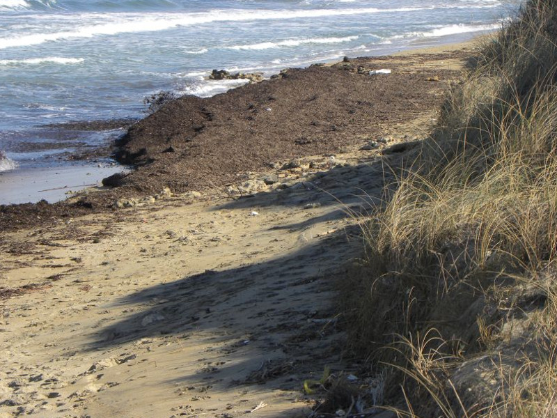
The Regional Nature Park Dune Costiere from Torre Canne to Torre San Leonado extends over 1,100 hectares in the territories of Ostuni and Fasano, along a 8-km-long coast, and it includes the inland agricultural areas occupied by centuries-old olive groves and ancient "masserie" (typical farms). The perimeter follows the 55-km-long course of the "lame" (erosion cracks), and it includes the Site of Community Importance (SCI) "Litorale brindisino" - which belongs to the Natura 2000 Network - whose goal is to safeguard natural habitats and endangered plant and animal species. This SCI is characterized by coastal wetlands having a significant value for rare and endangered flora and fauna species that reproduce here or stop during migrations.
The SCI
The SCI (Site of Community Importance) is a specific geographical area contributing to the conservation or restoration of the natural habitats and of the plant and animal species; or to the maintenance of the biological diversity in the related biogeographical region. The "litorale brindisino" SCI is characterized by the presence of coastal wetlands, where rare or endangered migratory bird species stop or reproduce.

The wetland and the fish farming
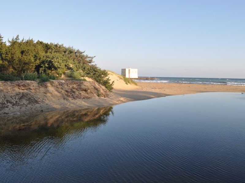
The Fiume Morelli wetland, situated in the areas of the Park behind the dunes, is characterized by the presence of water surfaces and ancient facilities for fishing. The L-shaped river winds for 800 meters and it is fed by many springs having a remarkable flow rate, from which a slightly salty and sour water flows, having crossed underground cavities made of calcareous rocks. The fresh water ponds shaped by the river in the wetland have been used for fish farming since the late 19th century, when the ancient plant was built. The plant was used until the 1980s and restored in 2009 with the launch of a certified organic aquaculture activity.
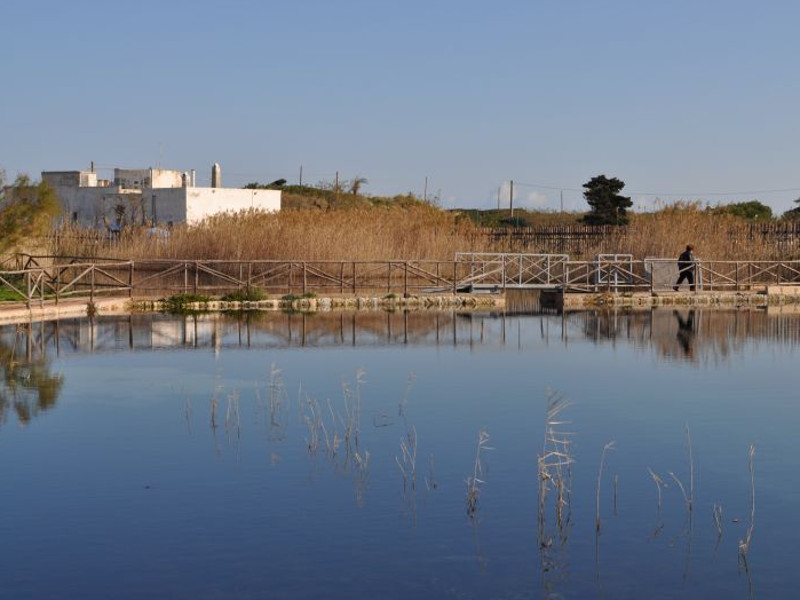
The plant consists of 7 basins and 11 river locks regulating the water regime and controlling the spontaneous movements of the fish between the ponds and the sea. The large tank surrounded by high walls and equipped with a small structure for the watchmen was used to contain the fish caught in the basins which would be sold in a later moment.
Further information
Centuries-old olive groves
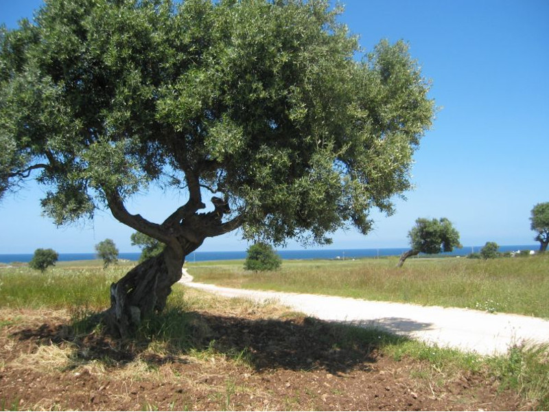
In the Park area olive trees have been cultivated since very ancient times, as it is proved by the centuries-old plants characterizing one of the most ancient agricultural landscapes in the Mediterranean, an undisputed symbol of Apulia.
Those olive groves are the same age of the Via Traiana - the important roman way inaugurated in 113 A.D. - which crosses the whole plain of the ancient Egnazia, in the territory of Fasano, up to the roman columns of the ancient harbor in Brindisi. The historical olive grove is a semi-natural environment which has remained unchanged over the centuries.
Characterized by an extensive cultivation it features 50 to 60 plants per hectare, placed randomly according to the original location of the wild olive, a spontaneous plant species of the Maquis shrubland which existed before the olive tree and was grafted into it to obtain the olive trees for the production of olive oil.
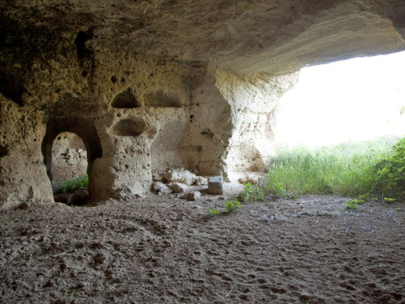
'Lame' and rock settlements
The "Lame" characterize the Park's territorial morphology; they are linear clefts of the land perpendicular to the coastline, with flat bottom and slightly sloping sides, which were originated by the erosive action of the surface water. They are real fossil rivers, since they prove the presence of ancient water courses. Today these canals still guarantee the outflow of the superficial water with a rapid flow water regime from the hills to the sea, after having crossed the plain of the olive groves, therefore they are considered as real "ecological corridors". The rich vegetation of the rocks and of the Maquis make the "lame" useful for the movements of the fauna, which uses them as a shelter and as a connection between hills and sea.
In the holes of the walls both migratory and non-migratory bird species can be observed, along with diurnal and nocturnal birds of prey, and the tangles vegetation functions as a shelter for small mammals that are sometimes disturbed by the agricultural uses of the land. It is a wide variety of species carrying out predatory activities in the surrounding countries, bringing benefits to the agricultural activities.
Further information
Ecosystems
In the protected area there are many habitats. Each habitat is the consequence of the geological, morphological and climatic features of the site that determine the presence of plant and animal species preferring those features.
Some of those habitats are considered as priority ones: they deserve a particular attention because they risk to disappear from the whole European Union. >>>