Protected Area
Identity Card
- Land Surface Area: 6'561.11 ha
- Regions: Piemonte
- Provinces: Novara
- Municipalities: Bellinzago Novarese, Cameri, Castelletto Sopra Ticino, Cerano, Galliate, Marano Ticino, Oleggio, Pombia, Romentino, Trecate, Varallo Pombia
- Establishment Measures: LR 53 21/08/1978
- PA Official List: EUAP0218
Nature
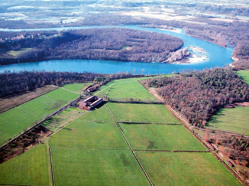
The Park is made of a valley which is at first very narrow, and then
gradually widens with gentler slopes covered with woods with big river
loops. In the south, the valley widens again by creating a series of
branches among gravel banks and aits, periodically submerged by floods.
This area is therefore characterized by the presence of several oxbows
where the water runs slowly, favoring the development of a very rich
aquatic vegetation. Another feature of the Park is the presence of
resurgences, places where the water maintains a constant temperature
during the whole year, giving birth to luxuriant and rich vegetation.
The woods, covering the 60% of the Park area, bear evidences of the
original plain wood and are dominated by broadleaf trees such as English oaks, hornbeams, elms, and locust trees (intrusive). The undergrowth is characterized by hazelnut trees, blackthorns, and hawthorns. Spring herbaceous blooming like dog's tooth, scilla, periwinkle, and primrose are typical of the Park. Of particular interest the aquatic vegetation of the oxbows with water-lilies, cattails, etc.
Among the mammals, we remind the presence of the squirrel, the wild rabbit, the hedgehog. Moreover, there are the hare, a non-autochthonous species which has been introduced with hunting purposes. Among the birds there are the mallard, the gray heron, the moorhen, the pheasant; among the fish, the trout, the pike, and the chub.
The Environments
The River
The river Ticino begins its course on the Swiss mountains and flows into the Lake Maggiore after drawing a large region in the Swiss territory which has taken its name: Canton Ticino.
It comes out from Lake Maggiore between Sesto Calende and Castelletto Ticino, where its Italian course begins in a narrow and deep valley which gradually widens descending towards the south. After a route of more than one hundred kilometers leading it to cross populated provinces like Varese, Novara, Milan, and Pavia, it flows into the river Po near the bridge of Becca.
The Oxbow
The oxbows are stretches of water which now the river invades in the periods of flood. They were, until not a long time ago, secondary branches of the river, and sometimes its main course.
The resurgence
The resurgences create a series of considerable micro-environments. According to the size, the depth of the watercourse and the speed of the current, there is a different distribution of the aquatic flora, which often consists of not very known species.
The meadow
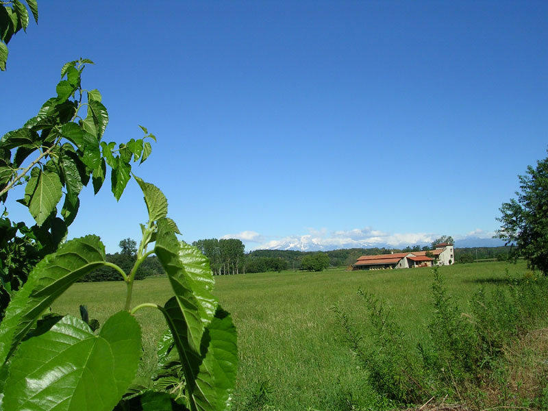
In Ticino Valley, the most widespread agricultural cultivation is still the meadow. The meadows are irrigated by using the water of Ticino, supplied in the valley through a thick net of irrigation ditches and canals which have been built by man during the centuries.
The moorland
From Bellinzago, and towards the north to Castelletto Ticino, you can visit the so-called "baragge" (a word used in Novara to define what in Lombardy they call "moorlands"), which cover the upper soils of the northern part of Ticino Park.
The woodland
With their 3,500 hectares, the woods are the main element characterizing the landscape of Ticino: they cover terraces, coasts, and the areas along the river, alternating in the plain valley with the cultivated fields.
Geomorphology
The environmental heritage of Ticino Park, both as far as vegetation and its considerable fauna are concerned, does not only derive from the combination of a watercourse and of particular climatic conditions, but also from the particular geologic events which interested the area.


