Points of Interest
The Natural Environment
The Apennines are characterized in their higher altitudes by beech
woodlands and mountain pastures, by rocky slopes and deep gorges from which
the watercourses spring. The mountains gently slope down to an area of
high hills still characterized by precious woods and by pastures.
At lower altitudes there are some copses and some cultivation, the via
Flaminia and the historical centers, and finally the rivers Sentino and
Chiascio.
The mountain surroundings are populated by the wolf and, probably, by
the wild cat; moreover, there are the fallow deer, the wild boar, the
porcupine, the marten, and the hare. There are also some specimens of
golden eagle, the hawk, the partridge, the rock partridge, the eagle
owl, the kingfisher.
The river crayfish still lives in the high part of the watercourses together with the brown trout.
The History of Man and its Signs
The original Umbrian civilization was replaced in its first expansion
by the Roman one and already in 220 BC the censor Caio Flaminio started
the building of the via Flaminia to link Roma to the high Adriatic area.
Helvillum Vicus (Fossato di Vico), Suillum (Sigillo), Ad Ensem (Scheggia) - respectively Roman federate center, municipium, and
Statius - were always in the Roman political and cultural orbit first,
and then in the Byzantine one, forming with their territories a piece
of the passage that definitively linked Roma to Ravenna despite the
pressure of the Longobard dukedoms. Castrum Costacciari (Costacciaro) was built by the Town of Gubbio around 1250 to fortify
the eastern town border together with Scheggia; Sigillo and Fossato
instead were part of the territory of Perugia that assured to itself,
thanks to the passage road, the access to the salt market from the
Adriatic Sea.
The archaeological finds linked to the via Flaminia
are of great importance, conserved in antiquarium, and still visible in
their original monumental settlement at the Pontespiano.
The historical centers of the four Towns are of great importance for
their culture and landscape, rich in walls and defensive towers, in
churches, in pictures, in fossils collections, in rare archival
documents.
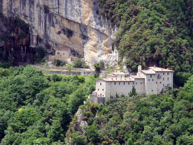
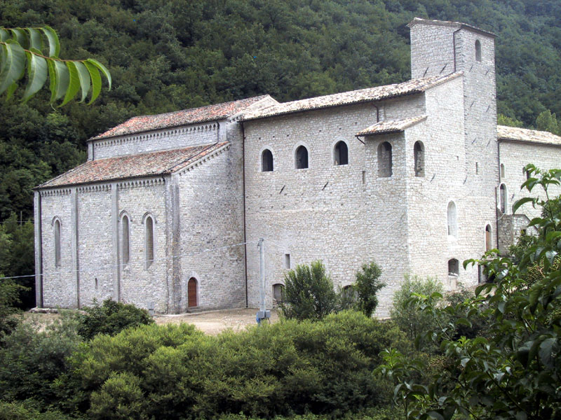
In the northern part of the territory there are several Benedictine and
Camaldolensian abbeys, and among the most important ones: Sant'Emiliano
in Isola Fossara and the Hermitage of San Girolamo in Pascelupo.
- Cultural Heritage, Civil and Religious Monuments (Italian text)
The Most Important Environmental Features
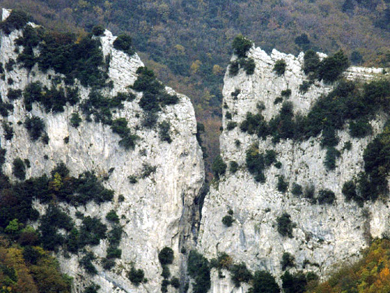
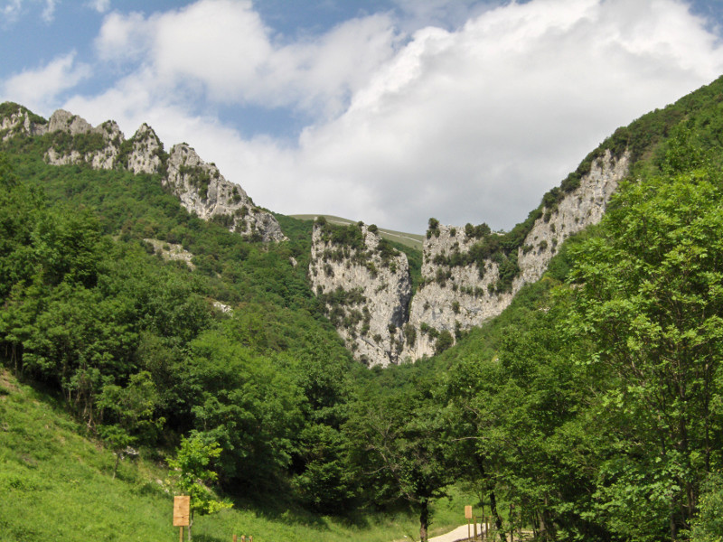
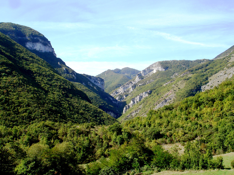
Rio Freddo Gorge
Deep carving marking mainly the eastern border of the Park. It is an imposing gorge which has been dug during the last million of years by torrent Rio Freddo in the calcareous massif of Lias Inferiore.
Balzo dell'Aquila Ravine
Deep carving of the liassic limestone of Mt. Catria.
Le Lecce
Imposing natural walls of the western slope of the Park, situated immediately above the village of Sigillo.
La Muraglia delle Liscarelle
Characteristic white marly-calcareous formations outcropping from ancient detritus and cemented breccias.
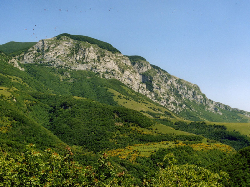
Corno di Catria
Solemn and spectacular formation of Massive Limestone. Site chosen by several species of avifauna living on the rocks.
Pian delle Macinare
Outstanding plateau characterized by karst phenomena, situated at 1135 m a.s.l. Rich in meadows and imposing beaches, an ideal scenario for hikes and cross-country skiing.
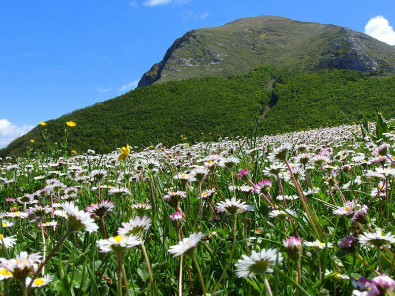
"Cacuminal" meadows
Seminatural grasslands used as pastures. You can mainly find Gramineae like the Fescue grass and the Brome. In spring, when several flowers bloom, these meadows become a multicolored palette.
Subterranean Caves in Valdorbia (Scheggia)
A network of tens of kilometers of great galleries, artificially dug on the left and right bank of the River Sentino in order to obtain marl from cement and lithographic stone.
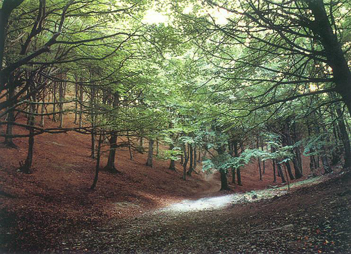
Beech Tree Woodlands
|
Centuries-old beech tree woods, like the ones of the Madre dei Faggi near Val di Ranco and the ones, even larger, of Col d'Orlando, of Mt. Le Gronde, of Niccolo, and of Corno di Catria. Valle delle Prigioni |
|
Rio Freddo and Rio delle Prigioni |
Valdorbia Paleontological Site
The fossils, stone stamps of organisms which lived in very far
geological epochs, are a great and fascinating natural element and, at
the same time, an inexhaustible source of study of what happened in the
past geological eras. In the area of Monte Cucco Park this heritage is even more astonishing and rich in finds.
The paleontological material is contained in the Jurassic-Cretaceous
calcareous and marly sedimentary rocks (from 200 to 120 million years
ago). The most interesting fossiliferous horizons come from Calcare
Massiccio, Rosso Ammonitico (Middle-upper Lias, 194-180 million years
ago), Grigio Ammonitico (Malm 155-145 million years ago) and, more
rarely, from Calcare Maiolica. In these strata there are mainly
ammonites, index fossils of the Jurassic period, belemnites,
brachiopods, lamellibranches, gastropods, and cephalopods.
The ammonites are spiral shells, whose interior consists of hollow
chambers separated by walls. They were Cephalopods molluscs (the
tentacles came out of the head which, in case of need, stretched out of
the shell) very similar to the current Nautilus, with which they shared
the floating system: the inner chambers were filled with water or
emptied in case they wanted to go down or came back to the surface.
In Sigillo, the Study and Research Center "Anzia Mercuri Brascugli" has
organized, with the support of Banca dell'Umbria and in collaboration
with the Earth Sciences Department of the University of Perugia and the
Municipality of Sigillo, a display with the most significant finds,
completed with an explanation regarding the research activities carried
out in the field and enriched with a scientific itinerary to promote
the knowledge of this field. The display has been organized on the
occasion of the establishment of Monte Cucco Park Authority.
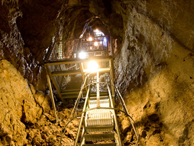
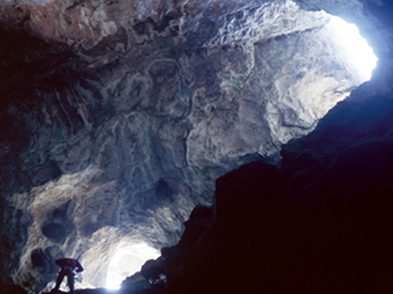
Mt. Cucco Cave
Mt. Cucco Cave has had a complex and long exploration history, whose
evidences are still visible today. Here and there, it is possible to
see names and dates engraved on the walls with the black smoke of the
torches: "Andromando 1555", "Ludovico 1551". However, the first written
documents about a tour in the cave were left by Earl Girolamo
Gabrielli, who talks about his tour in 1720.
Between 1883 and 1891,
Gian Battista Miliani, a brilliant papermaking manufacturer from
Fabriano, as well as an experienced mountaineer, carried out the first
systematic exploration campaign of Mt. Cucco Cave. The results of his
research activities were published in the Bulletin of Club Alpino Italiano,
n. 58 of 1891 with a detailed report called "La caverna di Monte Cucco"
(The cavern of Mt. Cucco), completed by the first planimetry of that
part of the Cave that today is known as the hiking branch.
From the
end of the 19th century, it will be necessary to wait for decades until
someone comes back to explore the many subterranean areas of Cucco. At
the end of the 1950, some speleologists from Perugia started a series
of research activities which, leaving from Miliani branch, led them in
1969 to reach the maximum depth of 922m and to sketch on the paper,
after covering them meter after meter, over 30 km of galleries (Italian
record for depth and development until the mid 1970s).
Mt. Cucco Cave, with its 30 kilometers and more of galleries and with a
maximum depth of over 900m, is one of the most important hypogeal
systems in Europe and, without a doubt, one of the most famous and
studied in the world. The natural show that could be appreciated only
by expert speleologists opens today for about 800m of subterranean
route for those who want to live a unique sensory experience, a journey
to the bowels of the earth developing among stalactites and
stalagmites, galleries, labyrinths, and underground passages.
Further information: www.grottamontecucco.umbria.it
Sport and Environment
The particular geographical, geological, faunistic, and vegetational
aspects of the Park favor many activities in the open air. The main
activity is without a doubt the excursionism: every year thousands of
people go along the more than 120 Km long thick path network, with the
"Sentiero Italia" and the "Sentiero Europa 1".
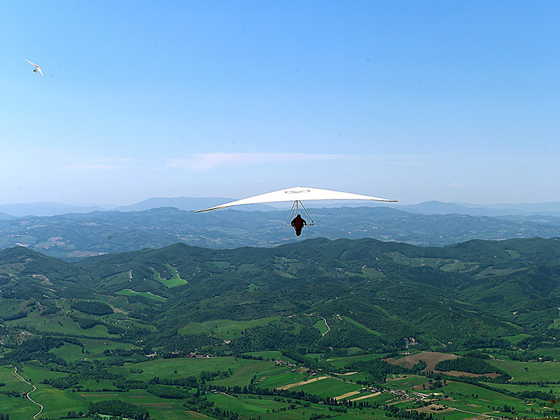
Gliding (hang gliding and paragliding) can be practiced in Monte Cucco, thanks to the favorable ascending currents.
The huge and fascinating subterranean world of Monte Cucco gives the
possibility to practice speleology, while the considerable presence of
superficial and subterranean waters running through the gorges and
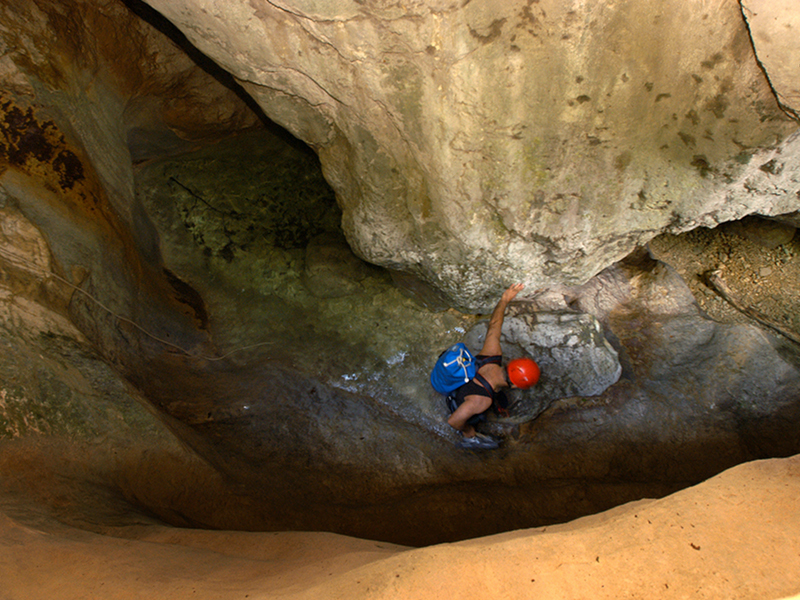
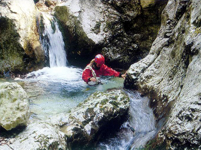
ravines give the possibility to practice canyoning.
Moreover, it is possible to practice cross-country skiing in Pian delle
Macinare, sport fishing along the river Sentino and the stream Rio
Freddo, mountain-bike and horse riding excursionism along the several
itineraries.
Moreover, the whole Park, thanks to the great environmental variety is
a very important place to practice environmental education.