Parks.it Homepage

Riserva Naturale della Val Rosandra - Dolina Glinščice


Itineraries

Nature itineraries and routes

The territory of the Val Rosandra-Dolina Glinščice Regional Nature Reserve is situated in the southeastern side of the Italian karst region, in the municipality of San Dorligo della Valle-Občina Dolina, which since 2006 has become the managing body of the protected area.

A typical feature is the presence of the stream Rosandra- Glinščica, the only one superficial water course in the Karst region, which flows in a deep crack that separates Mount Stena from Mount Carso. The two slopes of the valley have different climate situations due to the presence of the Bora and to the different exposition, which creates the best conditions for a rich biodiversity to develop.
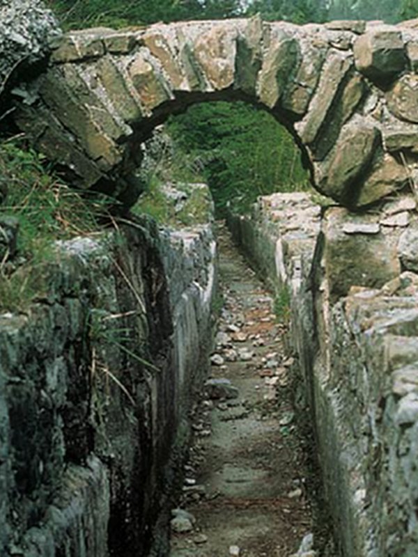
Noteworthy are also the still visible signs of human presence, such as the "castelliere" on Mount Carso, the Roman aqueduct from the 1st century A.D. or the S. Maria in Siaris medieval church. 

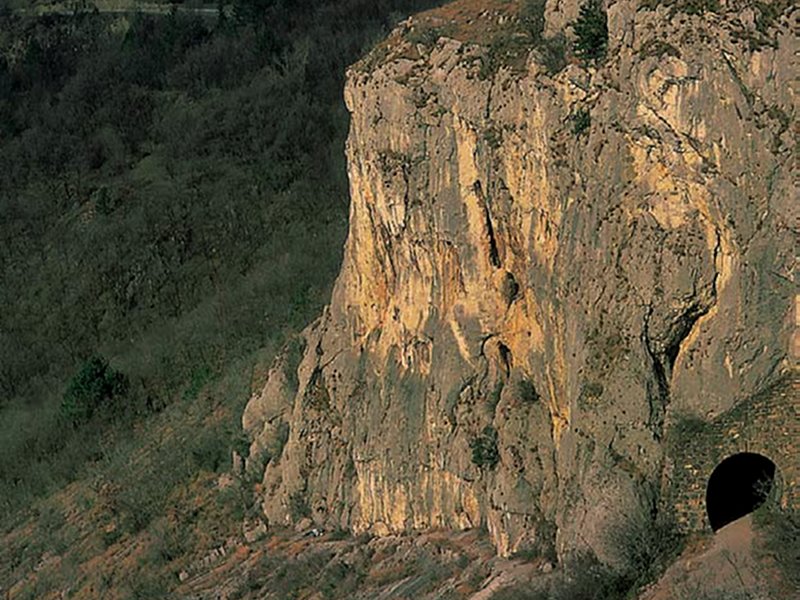
The vertical walls with the gallery dug in the mid-19th century for the ferrata

The Val Rosandra-Dolina Glinščice offers the opportunity to walkthrough many itineraries that allow visitors to enjoy different landscapes and views. The publications available at the Visitor Center will give you all the detailed information regarding the routes.

Stena
San Lorenzo-Jezero - Monte Stena
Departure: San Lorenzo-Jezero
Typology: On foot
Difficulty Level: suitabe for all
Duration: about 1 hour
Interest: Panorama
Griža
Bagnoli della Rosandra – Boljunec, Vedetta Moccò, Botazzo – Botač, Bagnoli della Rosandra – Boljunec
Departure: Bagnoli della Rosandra – Boljunec
Typology: On foot
Difficulty Level: suitabe for all
Duration: about 2 hours
Interest: Panorama
Cocusso - Kokoš
Pesek, Grozzana – Gročana, Tumulo Monte Cocusso – Velika groblja
Departure: Pesek
Typology: On foot
Difficulty Level: suitabe for all
Duration: about 3 hours
Interest: Panorama
Vertikala
San Lorenzo - Jezero, Monte Stena, Bottazzo – Botač, Socerb, Dolga Krona
Departure: San Lorenzo - Jezero
Typology: On foot
Difficulty Level: suitabe for all, with some demanding stretches
Duration: about 4 to 5 hours
Sentiero dell'Amicizia (Friendship path) – Steza prijateljstva
Bagnoli della Rosandra – Boljunec, Botazzo – Botač, Beka
Departure: Bagnoli
Typology: On foot
Difficulty Level: suitabe for all
Duration: about 3 to 4 hours
Cycle-pedestrian way Giordano Cottur
Trieste - Trst, Bottazzo - Botač, Draga, Kozina
Departure: Trieste
Typology: On foot, By bike
Difficulty Level: suitabe for all
Duration: about 6 to 7 hours walking
Interest: Archeology
share-stampashare-mailQR Codeshare-facebookshare-twitter
© 2024 - Comune di San Dorlingo della Valle - Občina Dolina (organo gestore)